Trimble Penmap
Hybrid Mobile App for Survey and GIS Data Collection
Trimble Penmap
TWO PLATFORMS TO FIT YOUR NEEDS
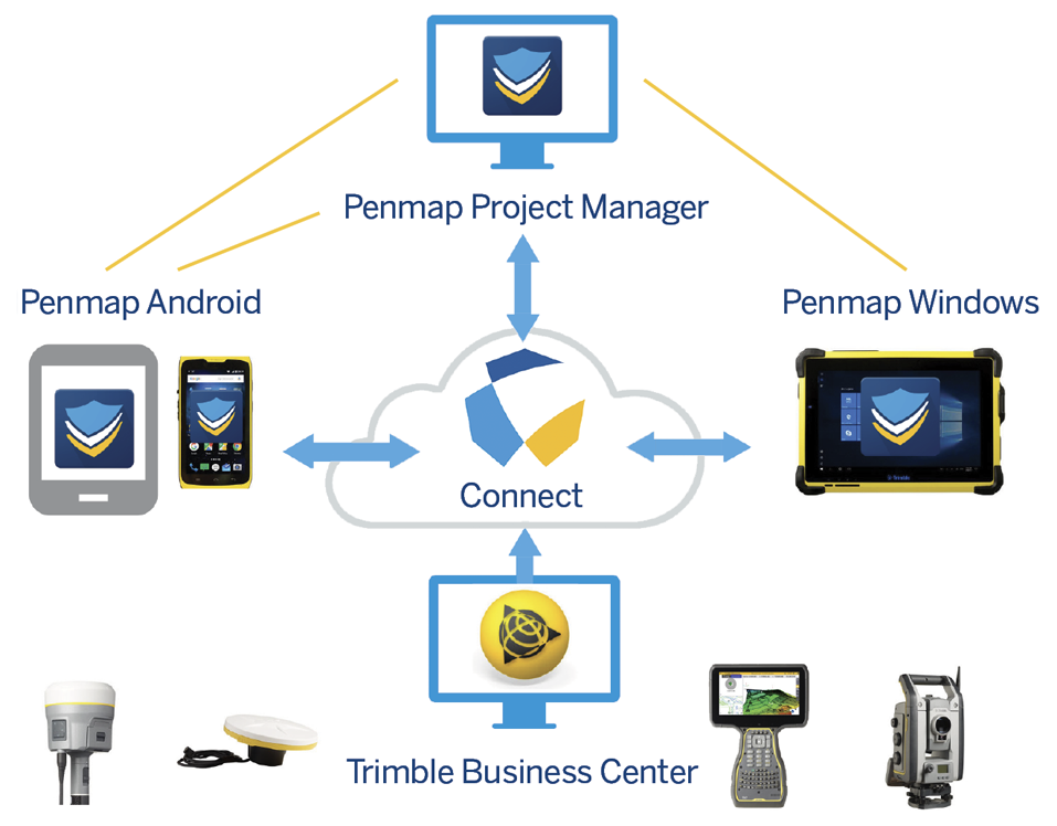
Penmap is a powerful, yet incredibly straightforward, cloud-connected application for cadastral field surveying and high-accuracy GIS data collection. Whether working on the Windows® or Android™ platform, Penmap is designed to provide both professional surveyors and field workers with a reliable and complete data collection application.

Flexible
Penmap offers both GIS and Survey capabilities in one application, to tackle all aspects of your job
Simple
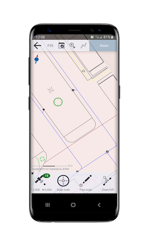
Penmap is designed with a visual, intuitive, easy-to-use map-based interface for entering and managing features and attributes
Accurate
Penmap supports real time correction source methods, including RTK, VRS, RTX, and Trimble® Catalyst™.
Penmap for Android
Penmap for Android supports a select set of essential features, keeping it focused and efficient – ideal for the work you need done.
Features
- Core survey functionality and highaccuracy GIS data collection
- Powerful but straightforward operations
- Intuitive interface using your own Android device
- Supports Trimble Catalyst software-based GNSS receiver for on-demand precise positioning
- Compatible with existing Trimble GNSS R-Series receivers
Penmap for Windows
Penmap Windows provides enhanced capabilities for executing more technical, detail oriented work, where both GNSS and optical tools are needed for high accuracy.
Features
- Real time editing and verification of captured data
- Full 3D surveying
- Support for manufacturer independent devices
- Direct logging of total station and GPS data
- Enhanced parcel editor tools
- Layout and design
- Area computation and calculated fields
- Capture photographs, sketches and signatures
- Configurable point and code numbering
The Penmap Ecosystem
